OUR NEWS
OUR NEWS


Consortis Geospatial recently showcased its expertise at the Geobusiness Show in London. The exhibition, held on May 17-18, proved to be a resounding success for the company, offering a multitude of networking opportunities, knowledge exchange, and exposure to cutting-edge technologies.
At Consortis, we believe that sustainability is more than a critical aspect of responsible business practice and a key driver of innovation and long-term success. Hence why we were thrilled to participate in the Sustainable Business Consultancy Project by the University of Edinburgh Business School, providing us with a unique opportunity to put our sustainability expertise into practice, improve our ESG performance and make a real impact to society.
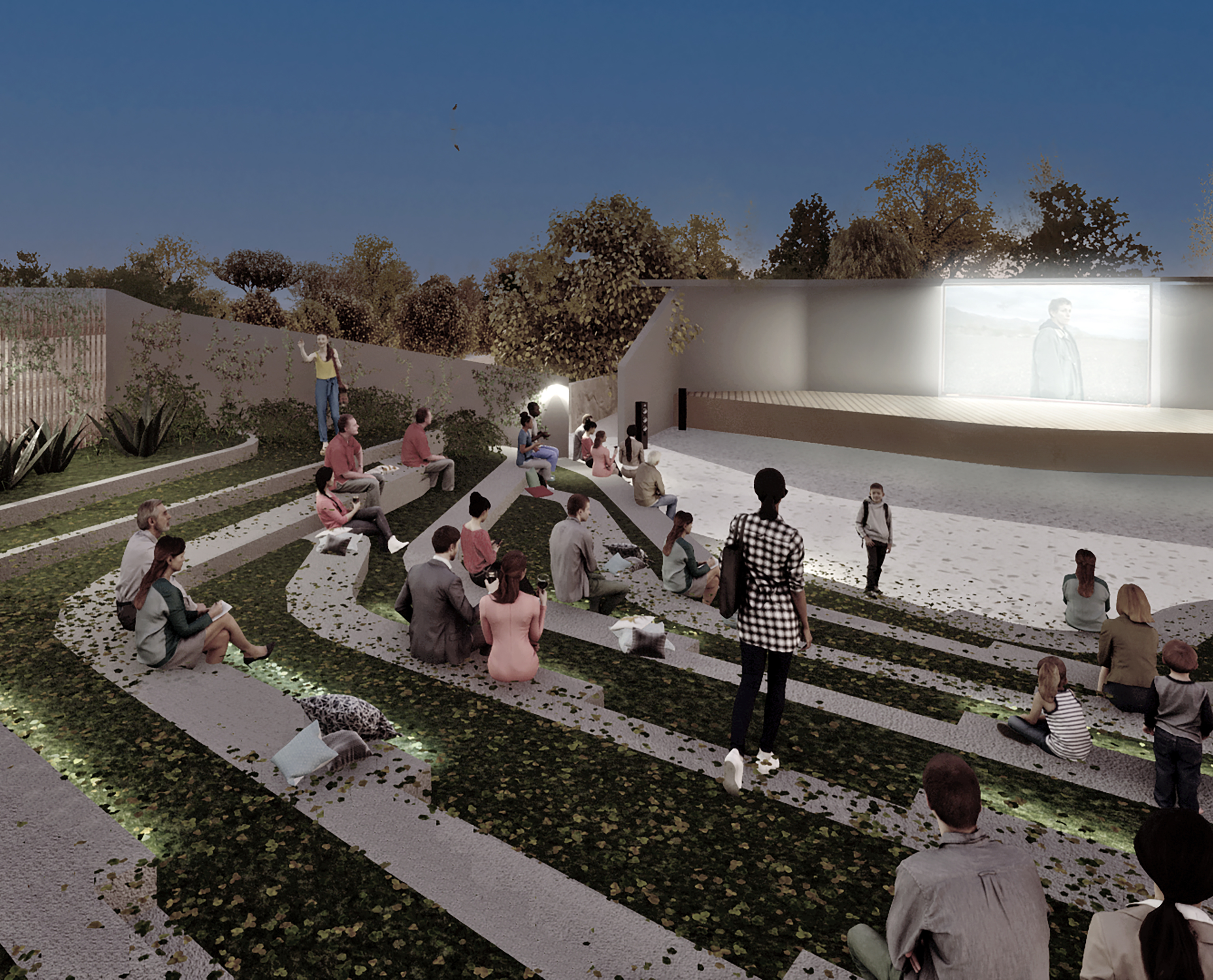
The subject of the competition was the redevelopment of an urban complex on the southern edge of the hill of Kadmeia, the historical centre of the city of Thebes. The intervention area concerns a network of public spaces of great importance for the functioning and identity of the city, as it currently contains important administrative, commercial, commercial, recreational and cultural uses, including protected monuments.
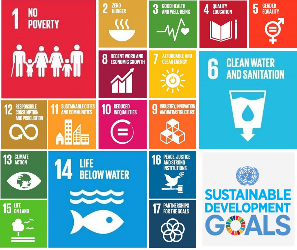
The Sustainable Development Goals (SDGs) are a set of 17 global goals adopted by the United Nations in 2015 as part of the 2030 Agenda for Sustainable Development. These goals aim to end poverty, protect the planet, and ensure peace and prosperity for all people. The SDGs are a universal call to action to end poverty, protect the planet, and ensure that all people enjoy peace and prosperity by 2030.
The 17 SDGs are as follows:
1. No Poverty
2. Zero Hunger
3. Good Health and Well-being
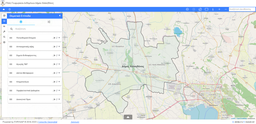
With the percentage of unknown or incompletely recorded real estate reaching 80%, the need for the Municipality of Chalkidona to digitize its real estate, was created. Therefore, in the framework of the project "Creation of the Geospatial Data Portal of the Municipality of Chalkidona", Consortis Geospatial completed the development of the real estate management system (Landify) of the Municipality of Chalkidona. City officials and employees can search for data within the Real Estate Database, obtain geometry and add new parcels or buildings.
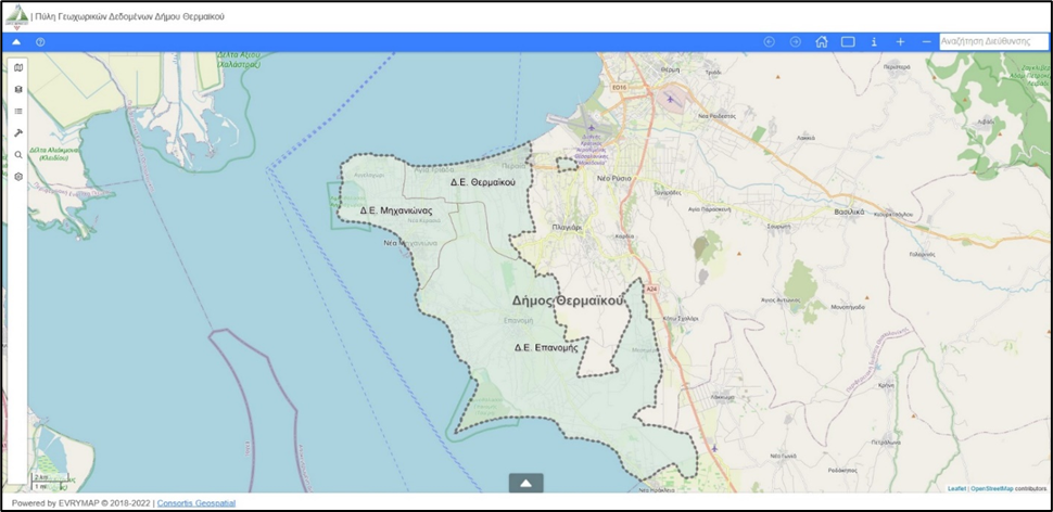
In the framework of the project "Design and Development Services for Geospatial Data Disclosure System", our company has developed the system for the display, disclosure and management of geospatial data of the Municipality of Thermaikos.
Through the application, in addition to the urban planning data that can be obtained by engineers and interested citizens, it is possible to view and download tables, data of Implementation Acts (diagrams, decisions and verbal) and data of the Municipality.
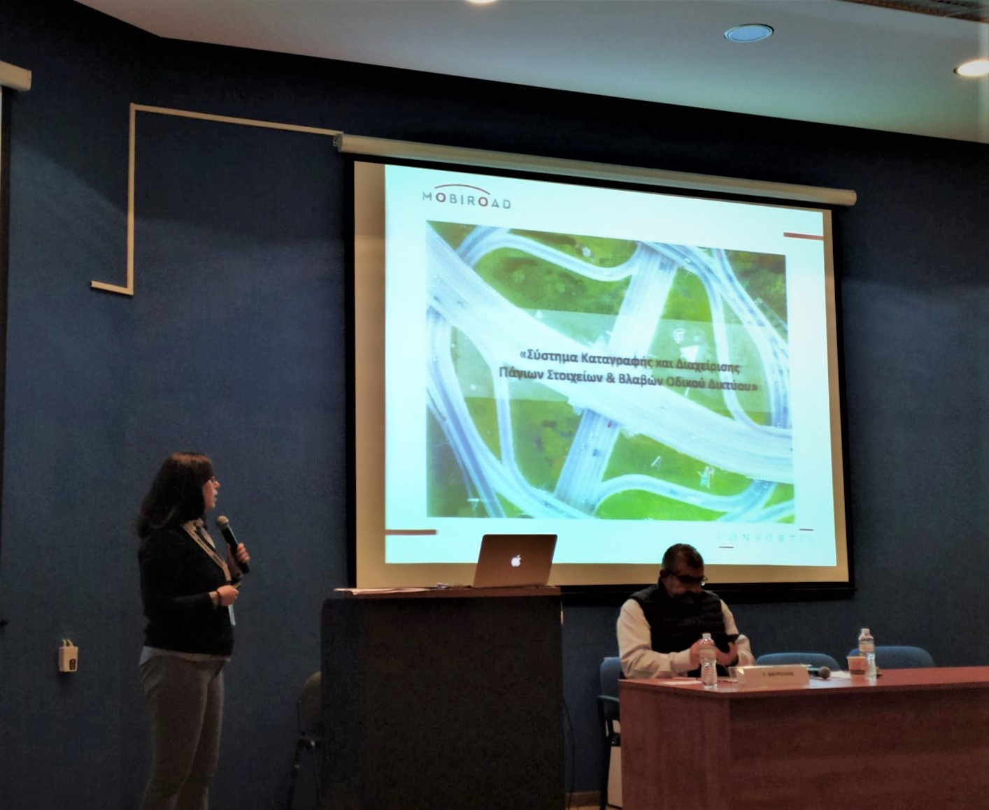
Consortis Geospatial team, in the framework of the 12th Panhellenic Conference, organized by the Hellenic Society of Geographic Information Systems (HellasGIs), presented the Mobiroad web application, a system for recording and managing fixed assets and road network failures.
The 12th HellasGIs Panhellenic Conference took place in Athens, on December 1 & 2.
Consortis Geospatial’s team completed the development of the expropriation management system of the Region of Central Macedonia, in the framework of the project "DIGITIZATION OF THE EXPROPRIATION ARCHIVE OF THE HELLENIC BROADCASTING CORPORATION OF GREECE".
Engineers and interested citizens can now browse the application, search for the expropriation they wish or submit an electronic application for the documents of the file of an expropriation.
What is air pollution? What causes air pollution? What is noise? How is it created and what can we do to reduce it?
On Wednesday 29th of December 2021, the contract for the study of the “Local Urban Plan of Pavlos Melas” was signed, at the City Hall of Pavlos Melas, between the Mayor Dimitris Demourtzidis and mr. George Tsakoumis, representative of the contractor ASSOCIATION OF FINANCIAL INSTITUTIONS "GEORGIOS M. TSAKOUMIS & CO.” with distinctive title “CONSORTIS” and “NETWORK TECHNICAL STUDIES SOCIETE ANONYME” with distinctive title “NETWORK S.A”.
With the participation of officials and special scientists, the workshop on "Urban regeneration and revitalization of environmentally degraded areas" was held, within the framework of the Act "Ecological consciousness strengthening” and promotion of environmental volunteerism in the Municipality of Ampelokipi-Menemeni" of the Region of Central Macedonia’s OP 2014-2020.
During the workshop, issues, related to the Municipality were discussed, in two key sessions:
Consortis, within the framework of the Action "Strengthening ecological consciousness and promoting environmental volunteerism in the Municipality of Ampelokipi Menemeni" funded by the O.P.
In the context of the implementation of the Act entitled "Strengthening ecological consciousness and promoting environmental volunteerism in the Municipality of Ampelokipi-Menemeni", CONSORTIS, which is responsible for the project, undertook the organization of interactive workshops, setting as a basic objective the sensitization of the public on issues of volunteerism and environmental protection, as well as their activation for initiatives in this direction.
"The future of Artificial Intelligence (AI)", was the central theme in the innovation and technology exhibition, that took place on October 14th 2021, at Thessaloniki’s International Exhibition and Conference Center. Beyond 4.0, came in Thessaloniki for the first time and lasted 3 days, aiming to turn the city into a technological and innovation hub.
The development of the building permit management system of the Pavlos Melas Municipality was completed in the framework of the project "Interoperability of Information Systems and Spatially Activated Mechanisms for Finding or Disposing Data in the Municipality of Pavlos Melas".
Engineers and citizens can now browse the app for the building permit needed and submit an online application. Login is achieved with TAXISnet codes on urban.pavlosmelas.gr
At the same time, they are responsible for the disruption and destruction of important
The importance of geospatial information, management of geospatial data through Geographic
The estimated subsidence phenomena in the area reached about -38cm in the Line of Sight of the satellites.

The past year has been marked by a series of successive conjunctures of increased hope for overcoming the pandemic, while lately, after the waves of health crisis and restrictions, we experience a strong energy crisis.
Nevertheless, the growth indicators show a positive course and form forward-looking conditions for those economic agents who have shown flexibility while trying to adapt to the volatile data of the time.
"Climate-related disasters accounted for 91% of all recorded disasters between 1998 and 2017."
Consortis’s Urban Planning and Archtectural Design team has been carrying out a project related to the 3D architerctural mapping of the building complex of the company “KTYP S.A.”, in the center of Thessaloniki around the Church of Agios Minas.
On September 30, 2020 Consortis organized a teleconference on behalf of the Region of Central Macedonia (RCM) in the frame of "Development of an Integrated Observatory System for Preventing and Managing the Risk of Coastal Erosion due to the Impact of Climate Change through the Utilization of Earth Observation Data” project.
In the context of social responsibility and in order to keep you better informed during this difficult time, Consortis Geospatial's team created an interactive map where you can find information regarding the spread of Covid-19, both globally and nationally (Greece).
The data is updated daily and comes directly from:
• Johns Hopkins University Center for Systems Science and Engineering (JHU CSSE)
• The National Public Health Organization of Greece (NPHO) Specifically, for Greece you can also find data divided by region.
The kickoff meeting for the traffic study of Eordaia Municipality took place on the 14th of March in Ptolemaida.